 |
| Coastal Modeling System (Version 2.5) |
|
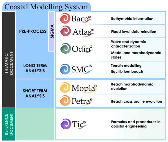
Coastal Modelling System (SMC) integrates a series of applications and numerical models structured according to the space and time scale of the different dynamics affecting the littoral and beach morphology based on different thematic and reference documents.
All the applications of Coastal Modelling System are integrated within SMC but can also be executed autonomously. In this sense, SMC can be seen as an independent application with a specific purpose.
The structure of the SMC and its relation with the science-based and engineering-based documents can be summarized in the following diagram:
|
 |
|
A brief description of the different modules can be found in the following links:
- BACO: Bathymetric information
- ATLAS: Flood level determination
- ODIN: Waves and Dynamics characterization
- MOPLA: Beach morphodynamic evolution
- PETRA: Beach profile evolution
- TIC: Formulas and procedures in Coastal Engineering


