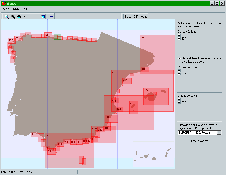

Bathymetric information
Baco provides the end-user with bathymetric information available for the study zone.
It provides:
- Bathymetric data, coastlines and images based on nautical charts which have been digitized
- The possibility of projecting this information to a specific UTM co-ordinate system depending on the selected ellipsoid in order to generate a project of SMC